The Ring of Fire Trek

The Ring of Fire Trek
Challenging Challenging
4000 - 6000m
13 Days
£3,095pp

Trip Overview

Mobile Trip App

Mobile Trip App

Take preparation to the next level with free access to our Mobile Trip App. Get maps of your trek, trip countdown timers, our favourite hang-out spots and heaps more. 


Ultimate Trip Flexibility

Ultimate Trip Flexibility

Moving a trip date should be easy right? Hassle-free flexibility. Move your dates, change your trek or your payments for free at any time as well as be covered under our Ultimate flexibility promise.

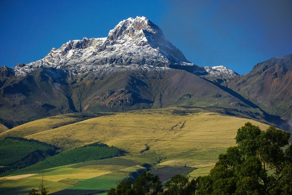
The Ring of Fire trek in Ecuador includes the challenging summit of one of the countries most famous volcanoes, Cotopaxi at 5897m as well as trekking through some of the most remote parts of the western Andes which is rarely visited by other tourists or mountaineers. This really is a trek for the ages as you spend 13 days experiencing one of the most authentic Ecuadorian experiences.

IMPORTANT INFORMATION - Update as of 02/02/2023

Please click here for an alternative itinerary which all Ring of Fire trips will follow until further notice.

Starting in the city of Quito you will already get a taste of what lies ahead as on a clear day you can see the snow-capped peaks of the volcanoes that surround the region and that's where you are heading, right into the Ring of Fire. 

The Surrounding Andes offer gorgeous nature, and exotic indigenous villages where you can mix with the locals and experience their way of life and learn about their cultures, all while starting to acclimatise for some of the volcanoes and high passes you will trek to. The main target is to summit Cotopaxi at 5897m but also trek through one of the most remote parts of the country visiting and staying in local settlements rarely visited by trekkers or mountaineers. The trip also includes ice axe and crampon training from some of the best mountain guides in Ecuador so you know exactly how to climb Cotopaxi and experience the breathtaking summit views.


Please Note

This trip requires a minimum number of 2 EverTrekkers to guarantee it goes ahead. We will notify you at the time full payment is due (6 months prior to trip start date) if the trip going ahead or if the minimum number of bookings has not been achieved.

We therefore recommend you do not incur any non refundable expenditure until you have received confirmation that your trip is guaranteed to proceed.
We recommend you read our minimum number T&Cs (Section 6c) before booking: https://evertrek.co.uk/about-us/terms-conditions


Join us on the Ring of Fire Trek

  • A unique and remote trip that offers the chance to summit Cotopaxi at 5897m.
  • Visit traditional Ecuadorian villages in the remote western Andes
  • Our Team in Ecuador has been guiding summits of these volcanoes and are some of the most experienced in the region offering you the best chance of success. 
  • We take special care of our porters & guides. They are probably the best equipped in Ecuador.
  • Your kit bag is carried for you, so you only need to carry a day pack
  • Prices include all climbing permits permits

Experience Required

The 13 day Ring of Fire Itinerary is a great trip and is easier than our other Summits of Fire trip that we run. This alternative has a larger trekking section which includes some remote trekking as well as the summit of Cotopaxi. It's still a great trek where you will trek over mountain high passes, up active volcanoes and reach almost 6000m so a good level of fitness is required as well as a sense of adventure. We recommend that you are a regular hillwalker and used to hikes of over 4-6 hours. It's very handy to have experience on steep ground in a mix of terrains but you will learn everything you need to know on the glacier training day built into the itinerary.

We can forward a detailed equipment list upon booking. Over the years, we have gained an incredible amount of experience and expertise in outdoor equipment and clothing. We have applied this to each trip that we offer and recommend what we believe to be the most suitable items for your trip.


What's Included?
  • Airport Pick-up and Drop-off
  • All accommodations for the 13 day itinerary
  • Full-day guided city tour
  • All overland transfers
  • All Trekking and climbing permits
  • All meals (breakfast, lunch and dinner) during the trek
  • All accommodation whilst on trek (Hut/mountain refuge/Tent)
  • Filtered water on the entire trek (Save on plastic bottles)
  • Experienced climbing and trekking guides and all support staff 
  • EverTrek Trip Planner 
  • Neck Buff
  • Oximeter & Heart Rate Monitor– To calculate Oxygen Levels and Heart rate to help with Altitude
  • Exclusive equipment discounts from Cotswold Outdoor, Osprey, Snow and Rock and heaps more
What's Not Included?
  • International flight to Ecuador
  • Ecuador travel visa
  • Meals in the city except for breakfast and other mentioned special meals
  • Personal expenses including soft drinks, alcoholic drinks, and beverages
  • Climbing gear (Ice axe, helmet, harness, crampons and crampon compatible boots) You can hire these locally on arrival)
  • Your travel insurance that covers Helicopter Evacuation
  • Any other extended trips and accommodation
  • Tips for guides and support staff

Itinerary

Hola! Welcome to Ecuador!

Today is the first day of your South American adventure and a member of the EverTrek team will be there to greet you and welcome you to Quito. Private transfer straight to the hotel for you to relax and get over the long haul flight and enjoy some free time to enjoy a meal with your group.

After breakfast your private tour around Quito begins, you will leave the modern part of Quito and head to the ancient historical part of the city where you will spend time basking in the local atmosphere. Some highlights include the La Basilica Church, La Compania Church and El Panecillo Hill. After some lunch at a local restaurant you will visit Mitad del Mundo where you can stand on the equatorial line and take part in some fun experiments!

A nice early start as get out into the mountains for some trekking! After pickup, the drive takes about 2 hours before you reach the start of the trail which lies at 3848m. The climb starts on a well-marked route through some of the local farmland before we start to ascend. Today is all about acclimatisation so we take it nice and steady before we reach the crater rim of your first Ecuadorian volcano, Pasochoa (4164m). This is almost the same height as Toubkal in the Atlas mountains but the landscape is very different as although you're on the summit of a volcano, it's very lush and green. If the weather is clear, you will enjoy spectacular views all the way down to Cotopaxi in the distance as well as a few other volcanoes in what the locals call 'Volcanoes Avenue. Once we tag the summit we will enjoy the descent back to the base of the volcano and take the 2-hour drive back to our accommodation for the night in a mountain lodge on the outskirts of Machachi (2930 m).

Ascent: 516 m / Descend: 516 m / Highest Altitude: 4164 m / Activity duration: 5 h

Early transfer (4 h) to the town of Angamarca (2985 m), located on in the west side of the Andes. The trek is in quite a remote part of Andes so although the roads are decent for the first couple of hours, you will soon be on a dirt road with a few lumps and bumps. All part of the adventure right! We will make sure to stop along the route as there are some great viewpoints. The start of the trek is in a remote village called Angamarca. This amazing and beautiful village still operates a very traditional Ecuadorian way of life, so spend some time looking around before your trek starts for real after lunch. The day’s trek lasts for around 3 hours and follows a local trail to our first camp for the trek at Los Pinos (3300 m). The night will be spent in a tent at the camp site.

Ascent: 315 m / Highest Altitude: 3300 m / Activity duration: 3 h

After breakfast and packing down the camp, we will follow the Yayachanchi’s valley along a river of the same name. The trek follows a dirt road for around 30 minutes before we reach the local trails. There is quite a lot of ascent here so get the legs ready for some lung-busting action! As you get higher, the trail steepens and the views become amazing as you pass corn and bean fields until you reach Yayachachi town (3900 m).

This isolated settlement was until recent time only accessible on foot or by horse but a recently open dirt road has improved the life of the local people. A short break as we take on some snacks before we continue up the valley and the well-marked ridge. As we gain altitude, the path traverses towards the east reaching the Pigua mountain pass (4200 m). After catching our breath we will descend down to one of the most beautiful valleys on the trek which includes seeing the awesome “La Chorrera de Pigua” (Tigua’s waterfall), where we will set up camp for the night at (4073 m).

Ascent: 900 m / Descend: 127 m / Highest Altitude: 4200 m / Activity duration: 6-7 h

Leaving the camp next to Pigua waterfall we will get off the beaten path along an almost hidden trail along the mountainside before reaching the highest part of the trekking part of the trip at Zumbagua mountain pass (4466 m).

This pass has some of the best views of the high Ecuadorian volcanoes that include Cotopaxi, Ilinizas, Chimborazo, Los Altares and you might even catch some smoke coming out of the active Tunguragua. The views from this pass are out of this world as you look down to the green valley floor far down below where there is a local Indigenous settlement where we will be passing through. As we descend the narrow gorge we will hope onto our ride back to the town of Zumbagua. Once we have grabbed some lunch we will also check out the Quilotoa’s crater lake (3900 m). Quilotoa is known for its almost perfectly round crater with a deep green crater lake. It's a great place to relax after the last few days trekking and enjoy some hydration and possibly a cold beer as you watch the sunset over the backdrop of the Ilinizas mountains.

Ascent: 393m / Descent: 766 m / Highest Altitude: 4466 m / Activity duration: 6 h

The long descent starts at around 8am as we hike around the crater rim on a spectacular trail (4020 m). As the route takes us around a third of the way along the crater rim, you will have the volcanoes of Cotopaxi and the Illinizas volcanoes to keep you company. Once around the rim, the path descends into the Guayama valley and follows a series of trails and dirt roads until we reach the Toachi River gorge (2995 m). This last section is quite steep following an old trail to a river crossing and once we are across, there's a short hike up to the town of Chugchilan (3198 m), where our return transport will pick us up and transfer the group back to Machachi where we will again stay at the mountain lodge.

Ascent: 203 m / Descend: 1025 m / Highest Altitude: 4020 m / Distance: Activity duration: 5-6 h

This morning’s goal is to climb the North Ilinza, one of the twin summits of the Iliniza massive that you would have seen from the high crater rim over the last couple of days. The north summit is the easier of the two from a technical point of view, but still a demanding physical ascent. The climb starts after a 1-hour transfer from the mountain lodge up to the parking place located at 3680 meters. From here, the group will follow a trail by the “paramo” (Andean highland), which changes as it gains altitude into rocky moraine.

The terrain gets steeper and steeper before reaching a well-marked ridge that ascends to a valley that divides the twin peaks and where the Nuevos Horizontes hut (4677 m) is located. After a short break at the hut, the climb continues towards the col and then up to the north side. The climb has amazing panoramic views, as it follows the southern ridge of the mountain with spectacular landscapes on both sides. As you ascend, the terrain will get a little challenging with some short but easy scrambling sections before reaching the summit.

Wahooo! Summit time!

Depending on the weather conditions and the physical shape of the team, the descent can be done by the same trail or following the northern ridge, down a big scree area making it into a circular route. Once Back at the parking place, the team will be transferred back to the mountain lodge.

Ascent: 1266 m / Descent: 1266 m / Highest Altitude: 5126m / Activity duration: 7-9 h

After several days of trekking and climbing volcanoes, it's time for a well-deserved day off! The idea for today is to recover from the previous days trekking and climbing and to enjoy and explore the lovely surrounding of Machahi. You could check out a local market, drive around to some nearby towns or just sit back and enjoy the mountain views. Later in the day, you will be picked up and transferred to the Cotopaxi National Park where you will spend a night in the mountain refuge at the foot of the volcano.


Time to get a good night's rest before we take on Cotopaxi!

After a good rest and a well-deserved breakfast, a 2 hours transfer will take the group to Cotopaxi’s Parking area (4587 m). We will then hike up for an hour to Cotopaxi’s mountain hut (4847 m) and upwards of around 45 minutes to the low part of the glacier (4990 m) where we can learn the skills needed for tomorrow ascent of Cotopaxi.

Once there, you will gear up and follow the guide’s instruction in the use of crampons, ice axe, rope use, and all the appropriate technical gear for the climb. This is in no way an alpine course, just a brief introduction into the techniques needed for the ascent. In getting on the ropes and practicing at this altitude, it will massively help with acclimatisation before we climb higher tomorrow. After the training has finished, we will head back down to the hut for the night (4847 m) but before we hit the hay, the guides will brief you on everything you will need for tomorrow's ascent and can assist with prepping your gear.

It's an early night as you will have your breakfast just before midnight before the big climb. Night at the hut in dormitories with bunk beds.

Ascent: 403 m / Descent: 143 m / Highest Altitude: 4990 m / Activity duration: 4-5 h

The summit day starts very early or you could say late as technically it stars the day before. Normally you will grab some food just before midnight and then start between 1am-2am but your guide will see how everyone is feeling and what the weather is like.

The ascent starts from the hut back up the well-marked trail that gently ascends over a fine stoned moraine for about 1 hour. Once on the edge of the glacier (4990 m), the group will gear up. Depending on the group numbers, we may split into two smaller teams with one guide for 2 customers so we can approach the mountain safely. The ascent of Cotopaxi is a physically demanding climb but as with all of our trips, the main challenge is in the mind so keep going, one foot in front of the other and before you know it, you're almost there. The glacier on Cotopaxi is normally quite safe and the climb is not technical but as it is an active glacial part of the mountain, it changes every year. Therefore we have to navigate this carefully especially if there are any crevasses. It makes it an epic and enjoyable climb as you cross this frozen landscape.

The first section that you will climb on the glacier is a gentle slope that gets steeper as it goes higher. There a series of switchbacks known as “Heart Breaker” so you can imagine what this part may look like. This is the toughest part of the ascent due to its demanding steepness and continuity but keep going, you got this!

After this a very nice ridge gradually gains altitude, passing close to the prominent rock face known as “Yanasacha” at about 5630 m. From this point there is a relatively long traverse to the right before another set of switchbacks that lead up to the crater’s rim and few meters later to the main summit. You did it! You summited one of the highest volcanoes on the planet!
Cotopaxi’s summit and the views are some of the most spectacular you will ever see so drink in the moment! As you look back down you can see the parts of the Andes you trekked a few days basck towards Cayambe, Ilinizas, Chimborazo as well as the active Tunguragua. The descent is done following the same route back and takes about 3-4 hours. Once back at the huts and after the whole group reunites, a short hike down (20 minutes) to the parking place and drive back to Quito for some celebrations (3 h).

Ascent: 1050 m / Descent: 1315 m / Highest Altitude: 5897m / Activity duration: 10-12 h

This day is to allow for extra time to reach the summit and account for any weather delays in the unusual event they occur. We will endeavour to keep to the main schedule so this day will likely be spent relaxing and celebrating in Quito.

Time to say goodbye to the volcanoes of Ecuador.

Dates & Prices

Monthly Payment Example

First...

Deposit

£200

Then...

19 Monthly Payments

£152

or...

1 Full Payment From

£3,095pp

July 13 2024 - July 25 2024

£3,095pp

10 Available Spaces

November 16 2024 - November 28 2024

£3,095pp

Or

£414 / 7 Months

11 Available Spaces

July 12 2025 - July 24 2025

£3,095pp

Or

£193 / 15 Months

10 Available Spaces

November 15 2025 - November 27 2025

£3,095pp

Or

£152 / 19 Months

11 Available Spaces